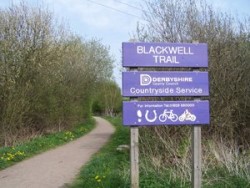
Blackwell Trail
The Blackwell Trail is a short, nearly 3-mile stretch of multi-user trail for walkers, cyclists and horse riders.
Barbecues are not permitted at any of our sites.
The Blackwell Trail is part of the Phoenix Greenways - a network of trails that run through Derbyshire and Nottinghamshire. This short trail has footpath links to Brierley Forest Park, Westhouses and nearby Blackwell Village.
What you might see
The grassland areas alongside the trail are being managed to increase their diversity. At different times of the year you may see St John’s Wort, field scabious and knapweed.
The wet areas alongside the Normanton Brook are great habitat for water voles. Also listen in the evening for the mating calls of frogs and toads in the spring.
Waterside Way
The Waterside Way runs along the Normanton Brook close to the trail.
The Hilcote Environment and Leisure Project (HELP) have created an area that is attractive to visitors and wildlife. It’s a lovely place to stop and enjoy a picnic.
Facilities available
-
Bridleway/Horse riding trail
Bridleway/Horse riding trail
-
-
Easy access for all
Easy access for all
-
-
Woodland with public access
Woodland with public access
Directions
You'll find the trail close to South Normanton in Hilcote Village on the B6406 or access off Fordbridge Lane, between Blackwell and South Normanton.
Parking
Follow the road through the village and there's a small car park on New Street next to Hilcote Miners Welfare and Community Centre, Ordnance Survey grid ref SK 452 577.
There's also a small car park at Fordbridge Lane, Ordnance Survey grid ref 439 577