In 1996 the Countryside Commission (now Natural England) published the Character Map of England which identifies broad tracts of countryside that display similar characteristics.
The work identifies areas like the White Peak and Dark Peak and describes the landscape features that define their character and local distinctiveness.
We have developed this work in partnership with the district and borough councils. These broad National Character Areas are sub-divided into landscape character types, such as riverside meadows and open moors, to describe the diversity of the landscape within the county (excluding the Peak District National Park).
Detailed mapping of Derbyshire's landscape character types can be found on our mapping portal.
Search landscape character types
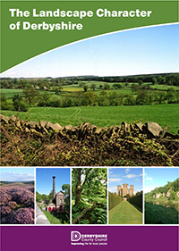
Written descriptions for the landscape character types of Derbyshire, supported by photographs and tables, have now been published in The Landscape Character of Derbyshire (fourth edition, March 2014).
What it is for
The work is intended to inform planning policy at the regional, county and local level, development control and countryside management.
Charging
If you require our officers to compile or 'clip' any information from the Landscape Character of Derbyshire publication, this will be charged for on a time taken basis. The hourly rate for compilation of the information is £35.01.
Contacts
Please contact Gary Ellis for a time estimate for undertaking any work: