Using our greenways you can leave the car at home, hop on your bike or on the bus and forget about parking.
The Chesterfield Greenways map and leaflet is attached to this page.
Much of the route is easy access, so if you're pushing a pram, using a wheelchair or a mobility scooter you can enjoy exploring the Greenways.
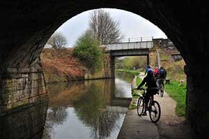
You can ride or walk the Cuckoo Way and Trans Pennine Trail alongside the Chesterfield Canal. You might spot the brilliant flash of a kingfisher or hear the plop of a shy water vole as it drops into the canal. From the new Staveley Town Basin the Trans Pennine Trail takes you north towards Sheffield and further onto the Coast to Coast route.
You can also head west from the town along the Holmebrook Valley towards Linacre Reservoirs with the Peak District beyond. Or follow the Hipper Valley and Rother Washland Greenways south from the town towards the Five Pits Trail and Amber Valley.
While you are out and about take a look at some of the other local attractions. You can easily get to Chesterfield's famous Crooked Spire and large open air market from the Greenways network. Renishaw Hall and Barrowhill Roundhouse Engine shed are also in easy reach.